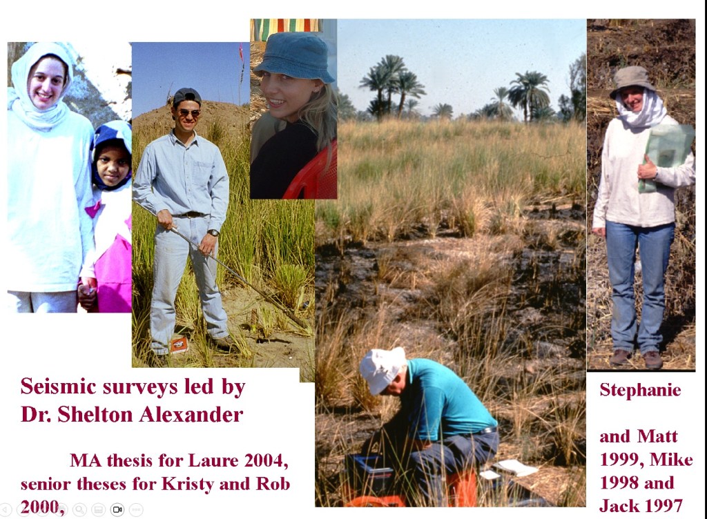
Dr. Shelton Alexander – Geophysicist

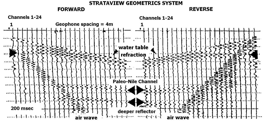

1997 Seismic data (upper example) from Dr. Alexander’s surveys provide new information: ground water, less than 2 m in depth and recurrent prominent reflectors, deep strata, 30 and 100 m which underlie the site and are shallow below the Wadi Abu Sufian ( lower illustration – Dr. Walters 1999 and employed by Dr. Alexander)
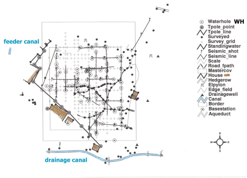
GIS generated map with locations of 1999 seismic surveys and monitoring wells WH at the Temple-Town Hierakonpolis main site, framed by houses on west and a few on the south (Cakir, 2001).
Valuable teamwork ensures high quality data.
Resident team designed large wheel/ spindle to carry, roll up or lay the long cables. Seismic surveys spanned the Temple-Town Hierakonpolis site linking also the ancient east and west outliers and nearby desert. Care and efficiency sped the long work days. All of us had to stop movement and be silent to permit sound waves to register on the seismograph. ‘Stop and go’ enlivened our fieldwork with Dr. David Gold to announce both.

Jamal was the successful ‘on site leader’ of Shelton’s team.
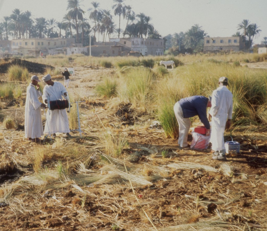
Resident team setup, protect, and collect the cables with geophones that capture and convey sound waves, 2000.
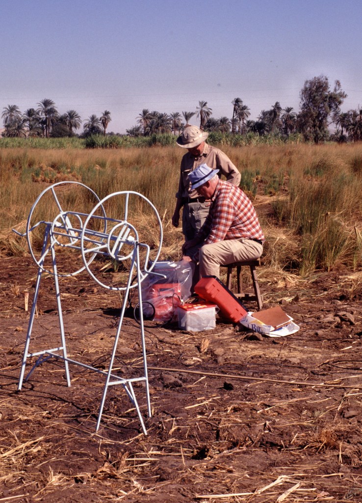
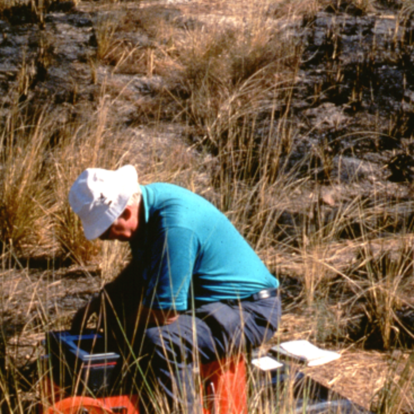
Dr. Shelton Alexander records and prints the data from the seismograph, viewed by Dr. Bruce Williams, 1999.
Bravo resident team: they designed and made this wheel (blue painted iron) to carry the wire cables of Dr. Shelton Alexander. They help create another map — essentially the placement of the geophones provides another map. The geophones not in this photograph are set into the ground, consistent to 3 or 4 m intervals. In the lower photograph, the orange geophones are closer at 1 m intervals.
This wired system with seismograph will ‘read’ the layers in the ground by means of sound waves. The location of the cables are surveyed by Dr. David Gold. All this data is entered into a GIS database by Dr. Recep Cakir. For selected parts of the Temple-Town Hierakonpolis, Dr. Shelton Alexander planned to create a tomographic, 3 -dimensional record.
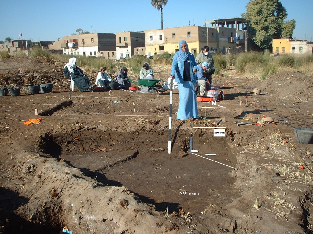
The orange geophones and cables are on the right of Dr. Shelton Alexander and Dr. Recep Cakir, 2006 photograph. Miss Amal measures the NW room for the shallow excavations. The MEN include Haj Saad seated with site gafirs while Said Bustawy is in charge of washing pottery, 15n9w.
The seismic survey works in tandem with and led to selective shallow excavations of Dr. Elizabeth Walters. Dr. Shelton Alexander re-checked his surveys across the site each field season and the west in 2006. Unusual patterns revealed by refraction merit further investigation. He chose to test data by placing the geophones on opposing directions and angles.

Dr. Recep Cakir integrated the seismic surveys, creating the GIS database. Recep, known happily as Ray, continues to update GIS 1997-present. We have tests and hydrogeologic data, topographic surveys, and archaeological evidence — more than a lifetime to evaluate.
Shelton was proud of his high resolution data. Dr. Richard Parizek, Dr. Recep Cakir, and Katarin Parizek confirm that Shelton’s evidence is accurate 0 – 10 cm for depth to groundwater. The deep data, cited earlier, connects the site to its geological history and the region. The shallow fast data above the groundwater proved to be important and rewarding for the geoarchaeological project, Temple-Town Hierakonpolis.
Dense debris helps us observe part of the many changes such as Islamic foundry pits. Other shallow, hard, fast anomalies led to special finds, such as ‘in situ’ offerings from earlier occupation. Shelton fostered exploration and research.
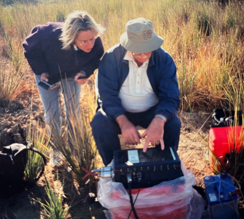
Happy to share and to teach, Shelton points out the on site data and refraction from sound waves in the seismograph to guest Merlinda Arnold, 2000.
