Dr. David P. Gold known to all as Duff – Geologist, P.G., long career S. Africa, Canada, USA
His vital gift, Topographical Maps : Temple -Town Hierakonpolis
Photograph 2011 by Kristen Barry with Mahmoud as rod man at rest.

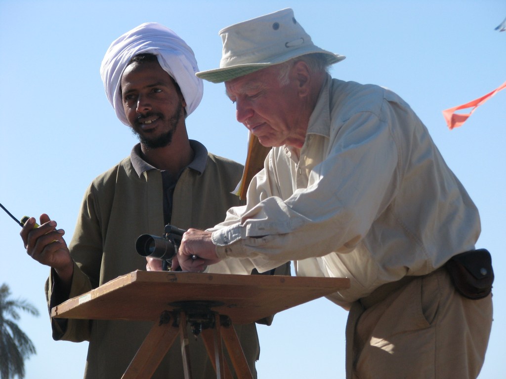
Actually a foursome (rod man not in view) seen by Mohamed Ibrahim and Mohamed Saad 2000 while Kamal Sidein offers his orange cap to shade the lens of the alidade (Felicia’s photo)
The surveying team varies but Kamal Sidein and Mahmoud Abdul Raizzig were most frequent. Each was the distant rod man, who is vital as the rod must be vertical for accuracy in measuring distance. Great work by the team!

Kamal almost matches the umbrella helping Gold survey on the brilliant sunny days (2005).

Cutting the long grass each field season is important but selective to work areas. 2008 Haj Said on left directs and Salah El Amir energizes his teammates. Said Bustawy is next, Mohamed Ibrahim inspects front center; on right Mohamed Sidein in blue and Salah Sidein with faz/hoe. Tall Ahmed Abdl Bast will measure water, Mahmoud el Sayed (Dr. Noor el Din’s graduate student) watches, Yousef Atef’s brothers in back.
Always to cut the long Halfa grass begins the fieldwork. All surveys and projects from 1999 – present rely on the MEN and this hard work. Thank you!
Foundational Mapping by Dr. David Gold
Essential to the Geoarchaeological, Hydrogeological and Geophysical Fieldwork is the careful mapping of Hierakonpolis – new maps of main site and two outlier mounds within the cultivation, Nile farmland, and the area to connect it to the region, Wadi Abu Sufian in the neighboring desert. Gold is meticulous and master topographer and surveyor. He employs theodolite and alidade with ground truth ever present in his lens and mapping. First maps in 1999 and each subsequent year were given to the Antiquities Office in Edfu and Cairo, Abbasia.
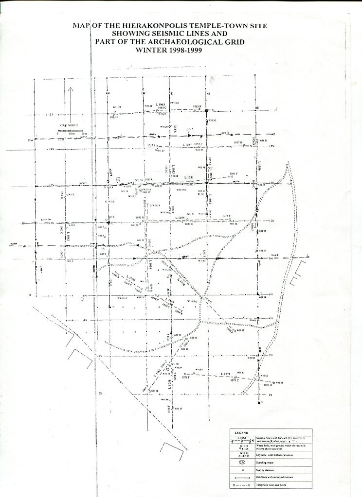
First map in 1999 with seismic surveys with archaeological 10 m grid and edge of the framing houses by Dr. Gold; north orientation.
New Topographic maps
Duff must use large rolls of paper to encompass the sites in the farmland and connect to the desert the broader context of site within its region.
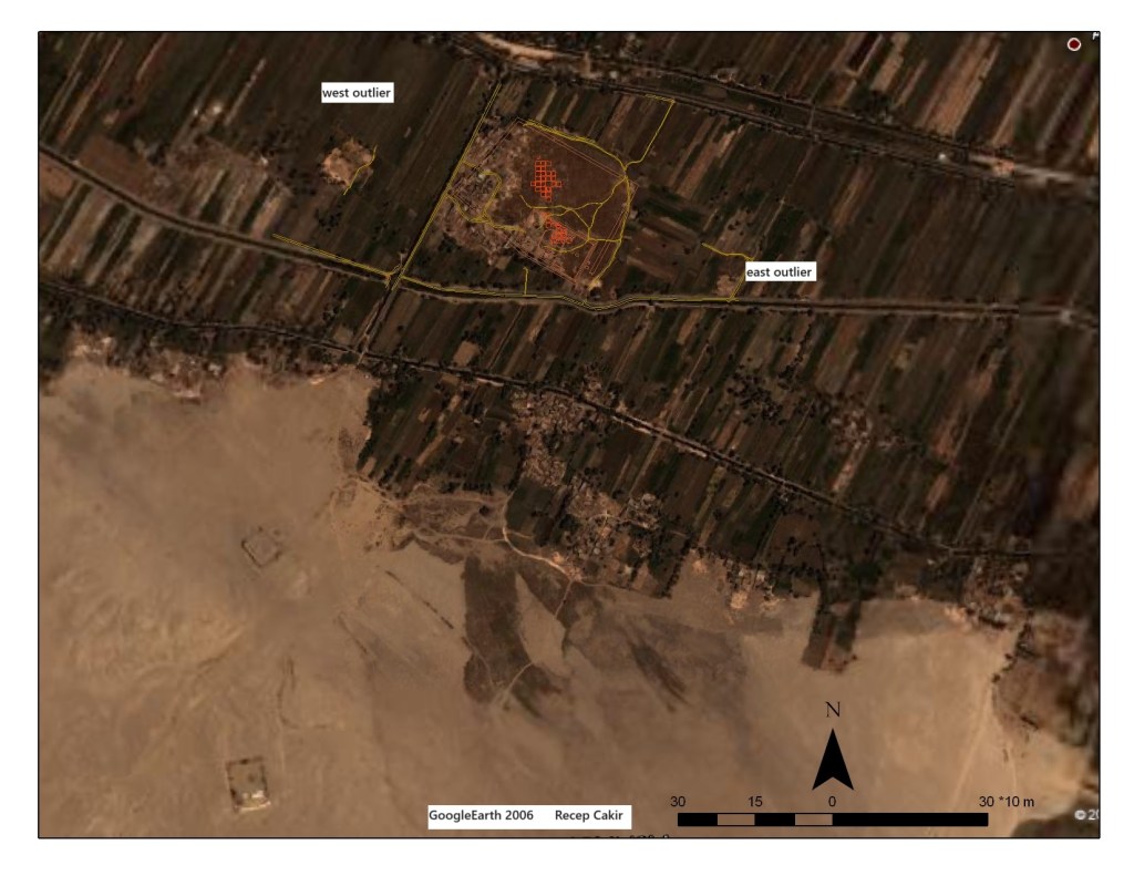
2007 Googleearth with site references made possible from Duff’s surveys and maps (Recep Cakir 2007)
The Main site Temple-Town Hierakonpolis on Googleearth 2007 has the archaeological grid from Fairservis excavations (marked red by Recep Cakir, GIS). Duff’s measurements extend beyond housing and into farmland because the Temple-Town Hierakonpolis occupies a large main area >3600 m. Into the fields are two outlying sites marked on the image above. Below this west grassy area is part of the small west outlier.
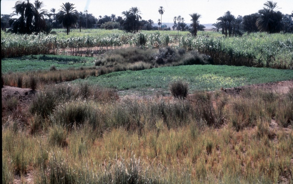
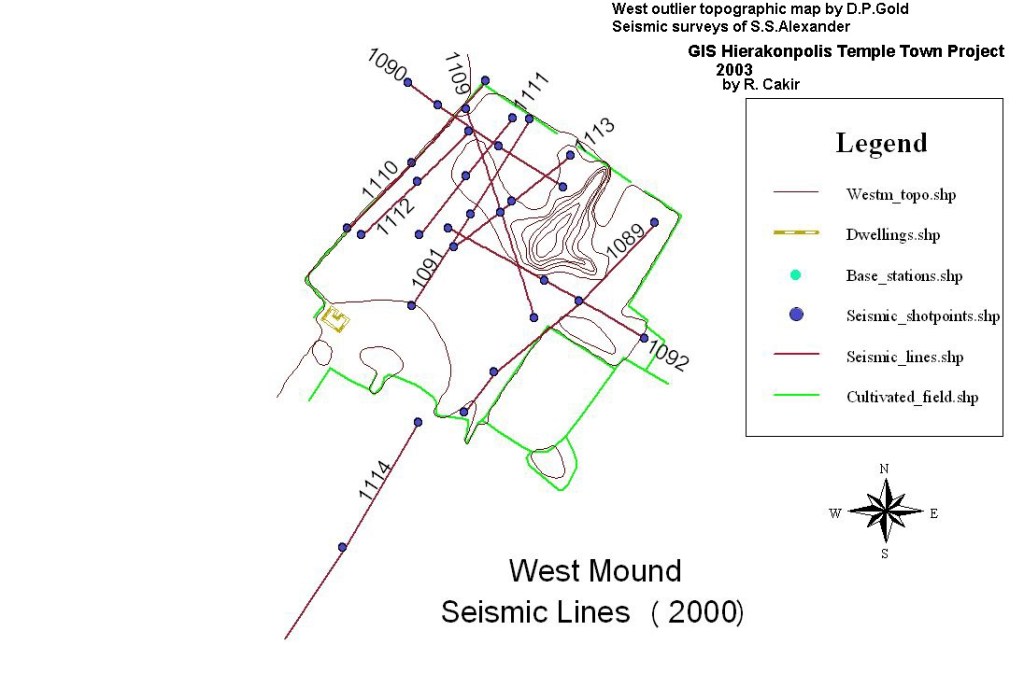
View from the west outlier ‘mound’ in 2000 (Walters).
West outlier is the grass small mound in the foreground and has 30 m partly cut by bulldozer for farming in 2000. Seismic surveys are also shown on the map (below) of this mound. The contours from Gold’s on site surveys and numbered lines are seismic surveys – digitized by Dr. Recep Cakir who made this GIS map of the west outlier.
Duff wears many hats:
He directed 1999 initial monitoring wells to 2 m depth, first following the seismic surveys. In 1999, each well was hand augered by Said Abd Bast and Ahmed AlSayah. Duff mapped the locations of the wells and the seismic surveys which have greater distance.

Ahmed Alsayeh and Said Abdl Bast auger the shallow monitoring well to 2 m as Dr. Gold directs and maps, while soils and water depth noted by Dr. Elizabeth Walters and Inspector Adel Kelany (hidden in blue) 1999.
Vital contributions by Gold
2011 surveys by Gold to Southwest in Temple-Town Hierakonpolis add the new deep wells of 2010 of 30 m depth and re check topographic data; he has included structures such as the small dome – archaeological storeroom built by Fairservis.
The large maps for Temple-Town Hierakonpolis has two outlier mounds, west one surveyed in 2000 and connect to the desert, the local and regional context. Gold’s archaeological 10-meter quadrants span all and continue the archaeological grid of Fairservis, Hierakonpolis Project 1967-94.

Part of the contour map of Temple-Town Hierakonpolis, 2001 (Gold) includes Yousef house and PW 3, private well 3 of that family.
On Gold’s maps, the contours use 0.5 m intervals and measurements above sea level (asl) often include 83 m asl. His maps mark WH as the monitoring wells (to measure depth to water). The longer numbers such as 1119c refer to seismic surveys, and Duff’s survey points and base stations. The rectangle is the house of Yousef family on the south. North is at the top of the map.

Ancient well is the low area that was dry in 1978 and wet in 2001 to present with Yousef’s house further south (2008 photo Walters).
The pool in the photograph above is permanent since 2001 occupying the ancient well discovered and marked on the plan published by the first excavators Quibell and Green in 1902. Behind the pool, the house of Yousef is on the site maps. Recent wells are important to include such as Yousef family well (PW 3) on the map of 2001.
People today remind us that the ancient temple and town were once alive with generations. The ancient well (pool in the photograph above) may also have had long use.
You may ask does the house plumbing or private well 14+ meters deep have any impact on the ancient site or are we asking the wrong question? Is the hydraulic system that served the ancient well active in our time?
